
Tonight lows will be mild in the lower 60s for most locations with clouds increasing. Monday, we're forecasting another hot autumn day with highs pushing into the low to mid 80s. We'll have partly sunny skies and southwesterly winds, but don't be surprised if the humidity feels more like summer. As we move into Monday night and Tuesday, all eyes will be on a developing system. We're expecting widespread rain and thunderstorms to move in, which will likely bring us the most significant precipitation we've seen in a while. The heaviest rain is expected across the southern half of the state, but we're still forecasting widespread rainfall amounts of 0.5 to 1 inch here in Central Indiana, with a chance for isolated heavier downpours. Tuesday will likely be a dreary day with overcast skies and
Warm Sunday, Rain Chances Looming!
 WLFI News 1821 hrs ago
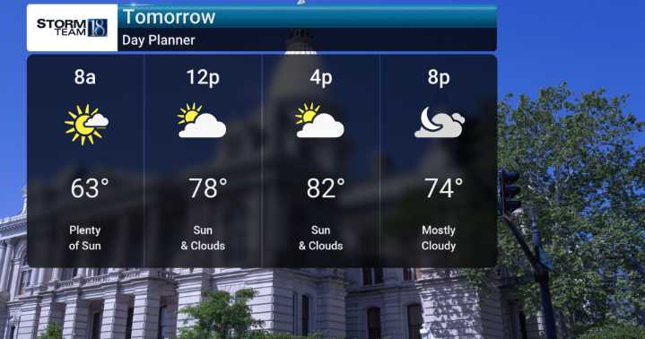
88

 Raw Story
 VICE
VICE NBA
NBA