
 Lehigh Valley Live
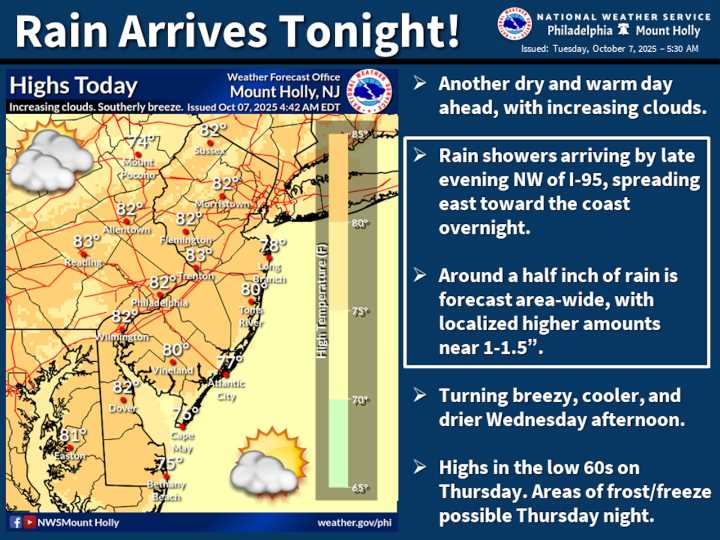
A warm day Tuesday will transition to scattered showers and a significant temperature drop Wednesday as a cold front moves through the Lehigh Valley.
Residents can expect rainfall totals around half an inch to one inch, with temperatures falling from the low 80s Tuesday to the upper 50s overnight into Wednesday.
After a mild morning with temperatures around the mid-50s to mid-60s, shower activity is expected to increase after midnight Tuesday. There is some potential for embedded thunder, though no severe weather is anticipated. The heaviest precipitation will likely occur between 2 and 8 a.m. Wednesday, tapering off by mid-afternoon.
Breezy winds are forecast to shift from the south at 5-15 mph Tuesday to out of the north on Wednesday, around 10-15 mph, behind the cold front. Gusts up

 PennLive Pa. Politics
 Ideastream
 The Philadelphia Inquirer Crime
 CBS4 Indy
 Shore News Network
 ABC 6 WPVI-TV
 RadarOnline