
 Savannah Morning News
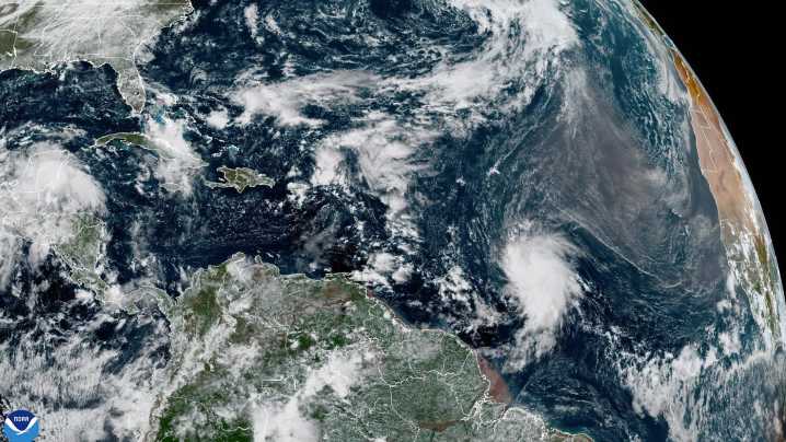
Yet another storm arrives from the eastern Atlantic Ocean, but it looks like the U.S. East Coast is well in the clear.
The Atlantic's tenth named system, Tropical Storm Jerry, has formed into a "sufficiently organized" system this morning, still far from land in the central Atlantic about a thousand miles away from the Windward Islands, the National Weather Service's (NWS) 11 a.m. forecast stated.
The system with 45 m.p.h. maximum wind speeds will become a hurricane by Wednesday or Thursday, said the NWS forecast. Tropical storm-force winds currently reach up to 140 miles from its center.
Jerry will make a right turn to the west-northwest during the next couple of days. By Thursday and Friday, the storm will be near or to the north of the northern Leeward Islands. Swells generating rip

 GV Wire
 The Oakland Press
 WWSB
WWSB KMVT
KMVT Eyewitness News 3
 WYMT
WYMT KBTX News 3
 KTIV News 4
 KY3
KY3 The Daily Beast