
A nice fall-like feel with cooler temperatures is on the way as well As expected it was a damp and dreary Wednesday across Central and Eastern Kentucky as a wave of low pressure along with a cold front brought multiple rounds of rain and a few storms to the area. Some of the activity was on the moderate to heavy side, creating some minor flooding issues despite the recent drought conditions we’ve seen. While most of Central Kentucky saw a good 1″-2″ soaking rainfall, several locations along the I-64 corridor (including Lexington) were more in the 3″ to 4″ range! In fact Lexington saw it’s wettest October day on record with nearly 5 inches of rain! Naturally this created some street flooding and high water issues with a number of brief road closures. On the plus side, the heavier rain will
Beneficial rain gives way to dry conditions mid
 News Channel 363 hrs ago
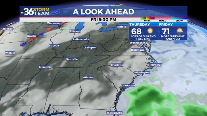
51

 WBTV Mecklenburg County
 Wilmington Star-News
 WFMY News 2 Crime
 Community Impact Newspaper
 WCNC Charlotte Crime
 5 On Your Side Sports
 The List
 Raw Story