
 Lehigh Valley Live
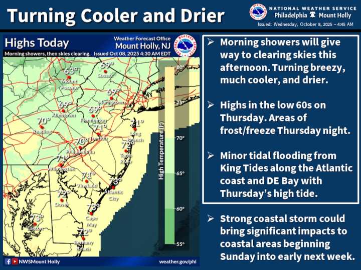
A Freeze Watch has been issued for Lehigh, Northampton and Warren counties Thursday night through Friday morning, signaling the potential for the first frost of the season with temperatures forecast to drop into the low to mid-30s.
Up first are rain showers as a strong cold front approaches from the north and west. Showers and possibly a thunderstorm are expected Wednesday morning with a west wind 10-15 mph becoming northerly during the morning.
The National Weather Service forecasts skies to clear by Wednesday night as temperatures plummet to the low 40s in the Lehigh Valley region.
Forecasters predict optimal radiational cooling conditions Thursday night, with clear skies and nearly calm winds creating an environment conducive to widespread frost development. Areas northwest of Inte

 WTAE-TV Pittsburgh
 NBC News
 York Dispatch
 PennLive Pa. Politics
 9&10 News
 RadarOnline
 Press of Alantic City Business
 AlterNet
 Breitbart News