
 WESH 2 News
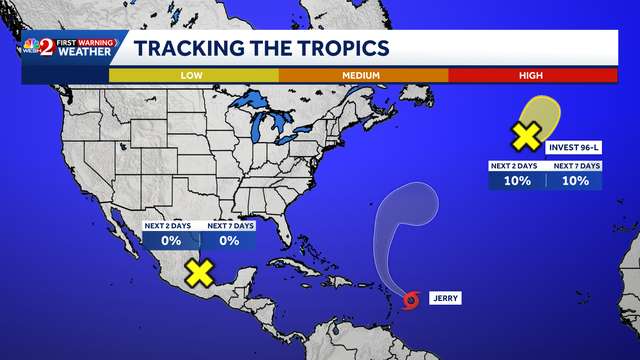
Tropical Storm Jerry is becoming better organized in the Atlantic, according to the National Hurricane Center.
Jerry is moving toward the west-northwest at 20 mph. A turn toward the northwest is expected later today, followed by a slightly slower northward motion on Friday and Saturday.
Tropical storm conditions are possible in portions of the northern Leeward Islands within the watch area later today into Friday.
Jerry is expected to bring two to four inches of rain across the Leeward Islands from Thursday into early Friday, posing a risk of flash flooding.
Maximum sustained winds: 65 mph
Minimum central pressure: 999 mb
Steady strengthening is forecast, and Jerry is expected to become a hurricane on Thursday.
At this time, the system is not expected to impact Florida or the U.S.,

 Florida Today
 NBC Southern California Local
 The Weather Channel
 KSL NewsRadio
 KSL Utah
 FOX Weather
 Rockford Register Star
 The Travel
 New York Post