
 WMTV NBC15
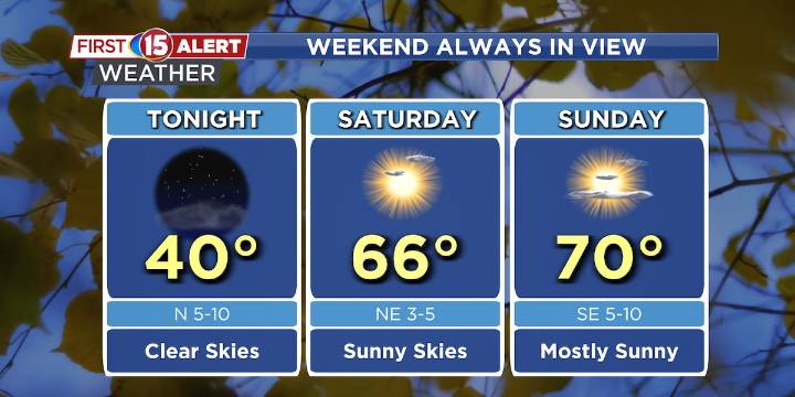
Cold night ahead with patchy frost to the north.
Great looking weekend with sunshine and mild temperatures.
Shower chances return Sunday night into Monday.
MADISON, Wis. (WMTV) - A cold front continues to move through southern Wisconsin this evening, bringing mainly dry conditions with limited moisture. Behind the front, skies will clear overnight as high pressure builds in, allowing for lighter winds and temperatures to dip into the upper 30s in cooler spots. A few areas of patchy frost are possible, but widespread frost is not expected. Click Here for Interactive Radar
What’s Coming Up...
On Saturday, cooler air and onshore winds will generate lake-effect clouds, especially over eastern Wisconsin. The combination of lake moisture and colder air aloft could spark a few light shower

 Santa Maria Times Local
 WAND TV
 WITN-TV
 AlterNet
 Mediaite