
 CNET
CNET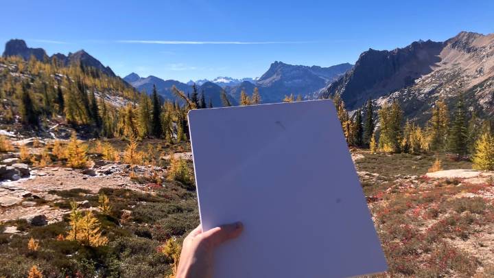
On almost every hike or camping trip I take in Washington state, there's a moment on the drive when service drops, music cuts out in the car and texts stop coming in. That's when I start hoping I remembered to download the trail map .
This disconnection is usually a welcome reprieve. I go off into the mountains partly to get a break from my phone, after all. But on this brisk Sunday morning in the North Cascades, that moment never came. I’d brought along a Starlink Mini in my backpack.
As my friends waited in line for the bathroom at the trailhead, I pulled out the small white square, about the size of a laptop, plugged it into my portable battery and waited for it to communicate with the Starlink satellites zooming invisibly 342 miles above our heads .
Locating local

 Android Central
 FOX News
 Futurism
 Newsday
 The Motley Fool
 CNBC
CNBC Raw Story
 The Daily Beast
 AlterNet
 NBC10 Philadelphia Entertainment