
 KOLR10 News
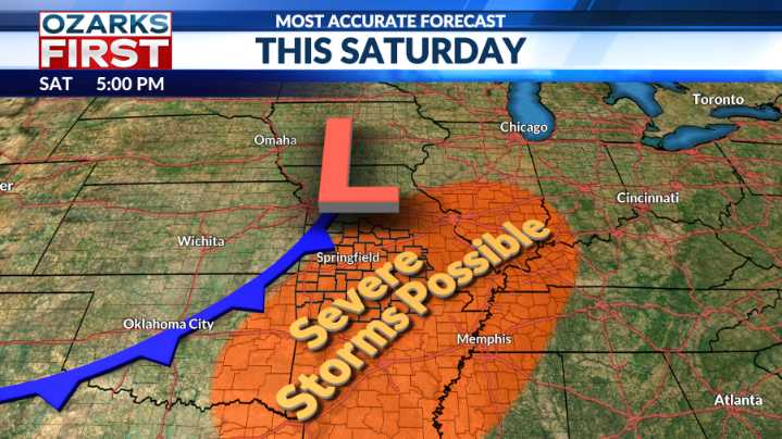
The week got off to a gloomy and damp start for some in the Ozarks. Rain amounts were light, just enough to get things wet. The rain mainly fell north of a Berryville to Salem, MO, line. The difference in cloud cover also led to a difference in highs.
The round of clouds and showers was caused by a river of clouds and showers emanating from West Texas and New Mexico. This river of unsettled weather was moving around a mountain of high pressure centered near Houston, a mountain that will shift north by Tuesday. This will result in the river changing course, shifting to a more northerly location. The result, sunshine and 80s the rest of the week.
This warm stretch won't bring record highs, but temperatures will still manage to run about 10 to 15° above normal for the middle of October.
A

 News Collection
 Bored Panda
 Salon
Salon SOFREP
 Esquire