
 WEVV 44News
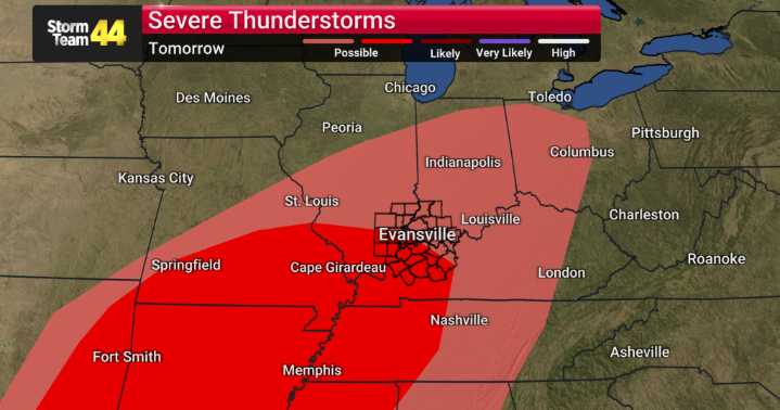
We're watching a significant weather pattern shift as we head into our weekend here across our region. Today, Friday, looks to be our last pleasant and warm day for a while, with plenty of sunshine and highs reaching the upper 70s and low 80s. We’ll see increasing high clouds tonight, keeping overnight lows mild, only dipping into the lower 60s.
The big story develops starting Saturday afternoon. A potent fall storm system is poised to move into our region, bringing with it a widespread and, at times, severe threat. On Saturday, we can expect thunderstorms to develop, and some of these could become severe.
The primary concerns with these storms will be damaging wind gusts, large hail, and even the possibility of a few brief tornadoes. We will be monitoring this evolving situation very cl

 Spectrum News NY1
 WRBL News 3
 WKYT
WKYT America News
 New York Post
 KIMT News 3
 KSNB Local4 Central Nebraska
 KKTV 11 News
 WCPO 9
 WDSU New Orleans
 Hawaii News Now
 KTAL-TV
 Grunge