
 CBS DFW
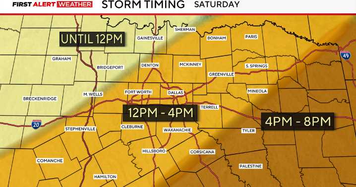
It is a First Alert Weather Day across North Texas due to the threat of strong to severe storms.
A strong cold front will tap into enough instability and moisture to spark up a few isolated to scattered severe storms throughout Saturday. As a result, the Storm Prediction Center (SPC) has highlighted a marginal and scattered risk across North Texas. Wind and hail will be the primary threats, but an isolated tornado cannot be ruled out.
The storms are expected to move from the west to the east ahead of a cold front throughout the day, with all activity forecasted to wrap up around 8 p.m. Saturday.
The SPC is expecting some of the strongest activity to be around 11 a.m. to 1 p.m. across the DFW Metroplex.
After the front, a cooler and drier airmass will settle in across North Texas. This

 Hattiesburg American
 Ann Arbor News
 ABC News Weather
 AccuWeather Severe Weather
 FOX Weather
 NECN Providence
 Sweetwater Now
 KARE 11
 WIS News 10
 The Federick News-Post