
 WAND TV
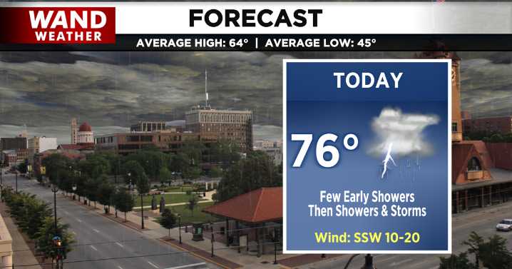
DECATUR, IL. (WAND) - Happy Saturday! After a long stretch of mainly dry and unseasonably warm conditions, a change of weather pattern will roll in today as a potent cold front.
We start the day with isolated and spotty showers. These showers and clouds may limit the diurnal heating pattern, and as a result, limit the instability (or severe thunderstorm fuel) for this afternoon and evening. However, we can still expect thunderstorms by midday, and as the front moves in, it arrives with its own ingredients to boost chances for strong storms.
Because of these brewing severe thunderstorm ingredients, the Storm Prediction Center has placed most of Central Illinois under a marginal risk for severe storms, and the Weather Prediction Center has issued an area wide marginal risk for excessive r

 People Crime
 TIME
TIME WCNC Charlotte
 The Atlantic
 ABC 7 Aurora
 Chicago Tribune Crime
 FOX 32 Chicago
 NBC Chicago
 KFVS12
 VARIETY
 Raw Story