
 WRCB-TV
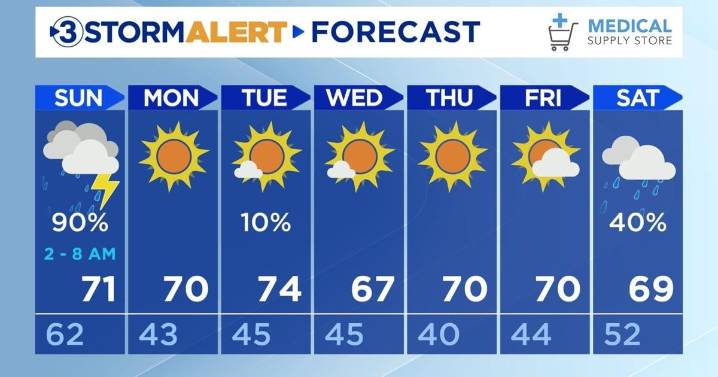
Happy Saturday, everyone!
Rain shower chances will taper off around 8:00 PM EDT tonight. The low will be 62 with mostly cloudy skies.
Sunday beginning around 2:00 AM, strong to severe thunderstorms will be entering the Tennessee Valley along with a cold front. The storms will last until 8:00 AM, and there are rain showers lasting until 6:00 PM. The main risks include frequent lightning and damaging wind gusts between 30-50 mph. The system is expected to weaken as it approaches the valley. There is a 2% risk for tornadoes, but after analyzing their potential to develop, they are extremely unlikely.
Monday will be drier with sunny skies and a high of 71. Temperature highs will be in the upper-60s and lower-70s the rest of the week with lows in the lower to mid-40s and lower-50s.
We will

 America News
 New York Post
 KIMT News 3
 KSNB Local4 Central Nebraska
 KKTV 11 News
 WCPO 9
 Hawaii News Now
 KTAL-TV
 Santa Maria Times Local
 Reuters US Top