
 News4JAX
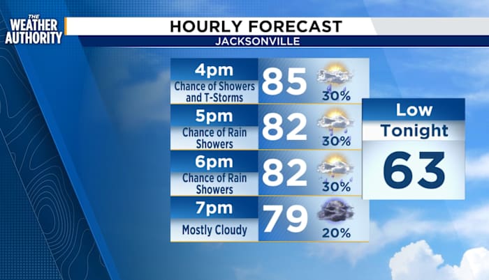
HAPPENING NOW:
Sunday afternoon storms are slowly moving towards the east from the I-10 and I-75 corridor. Storms are expected for Southeast Georgia and Northeast Florida through sunset. Though rain accumulation is expected to be less than a quarter of an inch, it will still be disruptive to outdoor evening plans.
In addition to the storm there are some severe elements to the system. However, I will be monitoring to see if the strong winds remain as the storm gets into the I-10 and I-95 corridor. It is currently approaching the I-10 and I-75 corridor.
OTHER HAZARDS
High Rip Current risk remains in effect for NE Florida coast.
Minor Coastal Flooding remains possible along the Saint Johns River.
TRACKING THE TROPICS
Near the Windward Islands and the Caribbean Sea (AL98):
Recent satel

 America News
 FOX 10 Phoenix Latest
 FOX 32 Chicago
 WSIL-TV
 WRCB-TV
 The Oregonian Public Safety
 WNDU
WNDU WCBI-TV
 NBC Connecticut
 ABC15 Arizona