
 WKOW 27
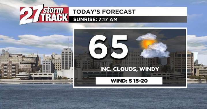
Download the 27 StormTrack Weather app to receive mobile weather alerts
Our Monday is starting off clear and chilly with temperatures this morning in the high-30s and low-40s. Throughout the day, we'll warm up to a high of 65 degrees thanks to an early afternoon warm front. We'll also have strong southerly winds between 15 and 20 mph, helping move warmer air into southern Wisconsin. Just behind the warm front is yet another cold front, which will increase cloud cover throughout the afternoon and bring evening showers. Rain is likely to begin shortly after the evening commute and dry up around midnight.
Overnight lows drop to the low-40s, and Tuesday will start off dry. We'll have another breezy afternoon tomorrow, with the cold front lowering Tuesday's high to just the low-50s; we're als

 WRBL News 3
 LEX 18 News
 The Bay City Times
 Associated Press Top News
 KOMU 8
 FOX 13 Seattle King County
 Raw Story
 Essentiallysports Football
 The List
 FOX News Politics