
 ClickOrlando
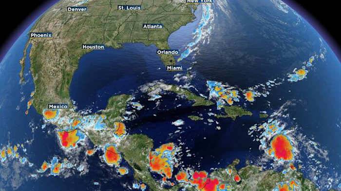
ORLANDO, Fla. – We’re keeping a close eye on a tropical wave moving through the eastern Caribbean.
This disturbance, known as Invest 98L, was a few hundred miles west of the Windward Islands early Monday and was producing a broad area of disorganized showers and thunderstorms packing winds of 30 to 40 mph. No description found
Satellite imagery still shows it lacking a closed center of circulation as it quickly tracks west.
By the middle to late part of the week, the wave is expected to slow down as it moves into the central Caribbean. That’s when environmental conditions become more favorable for tropical development, and a tropical depression is likely to form. No description found
Regardless of development, heavy rain and gusty winds are already impacting parts of the Windward

 New York Post
 The Daily Beast
 FOX 32 Chicago Crime
 WSVN 7 News
 WWSB
WWSB People Crime
 FOX 32 Chicago Lifestyle
 Raw Story