
 WJZ CBS Baltimore
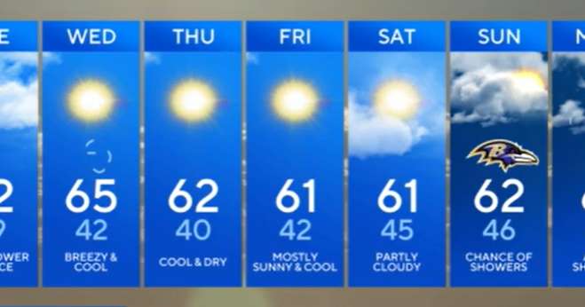
Clear skies and light winds tonight will let temperatures drop quickly across central Maryland. It'll be another chilly one — lows dipping into the upper 30s to mid-40s around Baltimore, with a few patchy areas of frost in the usual colder valleys. No frost alerts are needed since the growing season officially ended last week for much of the region.
TUESDAY — WARMER, BUT HOLD ONTO YOUR HAT
We'll shake off the chill pretty fast once the sun comes up. Southerly winds will crank up by midday, gusting 20 to 30 mph at times, helping push afternoon highs into the upper 60s and low 70s. A cold front will slide in late Tuesday night — but don't expect much rain. Just a few spotty showers around or after sunset, and most of us will barely see enough to dampen the pavement.
WEDNESDAY & THURSDAY

 KBTX News 3
 PennLive Pa. Politics
 FOX 32 Chicago
 Denver7 News
 NewsTalk 1280
 CBS19 News Crime
 KTVU Channel 2
 KNOE
KNOE WFMJ-TV
 CBS 42
 AlterNet