
 Ann Arbor News
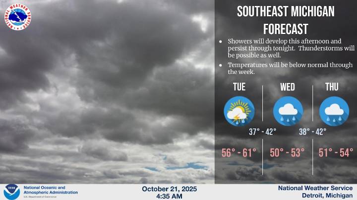
DETROIT - A cold front spread across Southeast Michigan early today, and that will touch off an unsettled weather pattern for the next few days. Chances for showers and even some isolated thunderstorms expand later this afternoon and evening.
Colder temperatures are also on tap, with daytime highs dropping into the chilly low 50s by Wednesday and Thursday.
Here are the forecast highlights from the National Weather Service office in Detroit:
A low pressure system positioned over northern Minnesota will dominate weather conditions across the Great Lakes region through mid-week, bringing a mix of rain, thunderstorms and gusty winds to southeastern Michigan and surrounding areas.
Light rainfall moving through the region this morning is expected to clear eastward by mid-morning. Temperature

 Lansing State Journal
 Detroit Free Press
 Kalamazoo Gazette
 New York Post
 Detroit News
 The Grand Rapids Press
 WFLA
WFLA Voice of Alexandria Sports
 Raw Story
 NBC 6 South Florida Entertainment
 Atlanta Black Star Entertainment