
 CBS DFW
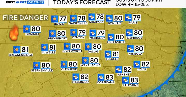
Tuesday was a cooler day in North Texas, although still above average, following the passage of a dry cold front in the morning.
As a result, very dry air and breezy conditions have settled in briefly for the midweek, but we do have some late-week changes on the way.
For Wednesday, expect a cool start, with lows in the mid-50s. Highs then return to the lower 80s during the afternoon, with lots of sunshine, and just a slight breeze.
By Thursday, clouds start to build as a warm front lifts through the region. This will usher in just isolated shower chances during the afternoon and evening.
This is all ahead of a stronger cold front and an area of low pressure arriving Friday into Saturday.
We have issued First Alert Weather Days for both Friday and Saturday for the risk of strong thunde

 FOX 13 Tampa Bay Crime
 Associated Press Top News
 The Bay City Times
 KOMU 8
 FOX 13 Seattle King County
 Kitsap Sun
 WV News
 Raw Story
 FOX News Videos