
 The Register-Guard
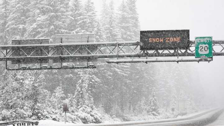
A foot of snow could fall on Oregon’s mountain passes this weekend as a cool and wet weather returns to the state.
The National Weather Service said an atmospheric river of moisture and cooler air will bring snow levels to between 3,000 to 5,000 feet between Oct. 24 and 26.
The best chance for major accumulating snow will be on Santiam Pass (Highway 20), Willamette Pass (Highway 58) and in the Mount Hood area on Bennett Pass, with less chances in the Government Camp area.
The snowstorm is likely to impact travel and anyone hunting or recreating in the alpine regions of the Cascade Mountains. It's likely to be the biggest snowstorm of the new season so far in the mountains.
The heaviest accumulations appear likely in the Central Cascades, as Santiam Pass will have a 75% to 85% chance of

 The Bay City Times
 Associated Press Top News
 KOMU 8
 FOX 13 Seattle King County
 Mediaite
 Esquire
 AlterNet
 FOX News Videos
 The List