
 KSNB Local4 Central Nebraska
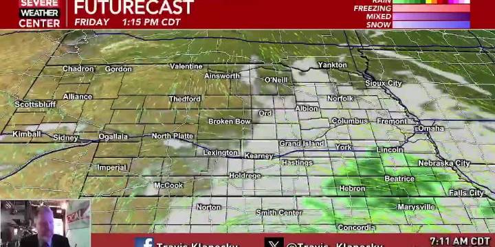
HASTINGS, Neb. (KSNB) - A bigger storm system passing to our south the next couple of days, well brush by the southeastern parts of our area. This has brought quite of few clouds into our area. That said, as you go to the west and northwest, the clouds won’t have as much of an impact, with more sun in those areas. This will impact temperatures. While starting off colder this morning, western and northern areas will see a nice warm-up. Areas under clouds will struggle to warm. High temperatures will range from the mid 50s southeast to the mid 60s northwest. Along with the clouds, a few showers and isolated thunderstorms will be possible for areas around the Tri-Cities and to the southeast.
As much of the rain activity clears out Friday night, the low clouds will expand to the west and nort

 WEVV 44News
 FOX Weather
 Raw Story
 Glam
Glam Post Register
 SOFREP
 CNN
CNN