
 FOX 26 Houston
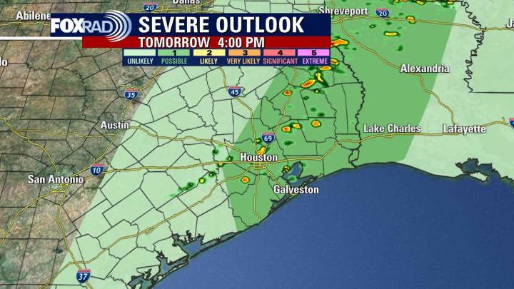
HOUSTON - Yet another cold front is expected Tuesday, bringing with it about a 40% chance of showers and storms, but finally some cooler fall temperatures.
Timeline:
We are under a low 1 out of 5 risk for a few strong to severe storms on Tuesday, mainly between 2 p.m. and 7 p.m.
Brief strong wind gusts from 50 to 60 miles per hour along with some hail will be possible as well as some brief heavy downpours.
Temperatures will soar to near 90 ahead of this front Tuesday afternoon.
Much cooler Wednesday, high fire danger
Temperatures Wednesday will be almost 20° cooler compared to Tuesday with highs not getting out of the 60s for most locations. But it will also be windy with gusts near 30 miles per hour and very dry.
That will lead to a higher fire danger Wednesday and a Fire Weathe

 WAFB
WAFB Fox 26 Liberty County
 ABC13
ABC13 KHOU 11 Texas
 Breitbart News
 Reform Austin
 KWTX News 10
 Community Impact Newspaper
 Click2Houston
 Page Six