
 WKYT
WKYT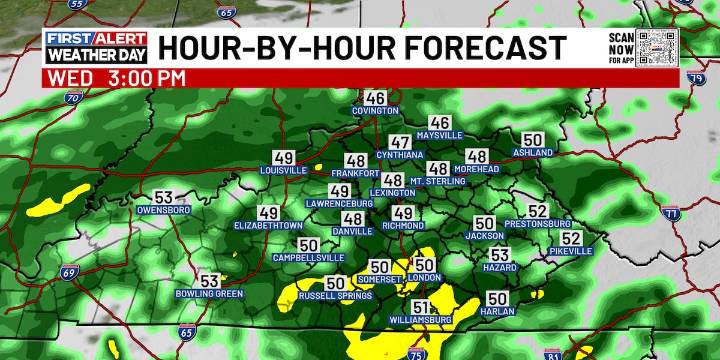
LEXINGTON, Ky. (WKYT) - as it tracksExpect plenty of rain, gusty winds, and a chill in the air that’ll make it feel even colder than it is.
Waves of heavy rain continue to rotate around an area of low pressure as it tracks through the Tennessee Valley today and into tonight. As that system wraps up and moves off to our east on Thursday, it will pull a powerful wraparound band of showers back across central and eastern Kentucky.
Most areas are likely to pick up between 1″ and 2″ of rain, with some spots potentially seeing even higher totals. Forecast models remain consistent in showing widespread heavy rainfall and blustery winds, with gusts topping 30 mph at times through Thursday. Afternoon highs will only reach the upper 40s to low 50s, but the wind will make it feel even colder.
In s

 America News
 Associated Press Top News
 FOX Weather
 KICKS 105
 CNN Climate
 KOLO8
KOLO8 Page Six
 Daily Voice
 Raw Story