
 USA TODAY National
COLUMBUS, Ohio - The Buckeye State's top politicians approved a new congressional map with bipartisan support on Oct. 31 − a compromise that avoids worst-case scenarios for both Ohio Republicans and Democrats.
Amid a national redistricting arms race to secure control of the U.S. House of Representatives, Ohio Republicans could have drawn a map that added three GOP seats. Instead, they targeted two Democratic districts held by Cincinnati Rep. Greg Landsman and Toledo Rep. Marcy Kaptur.
The seven-member Ohio Redistricting Commission unanimously approved the new map on Oct. 31. Republicans hailed the outcome as evidence that voter-approved, anti-gerrymandering rules worked.
"Coming to an agreement that is in the best interest of the state, not just the most vocal elements of either party, I think is some of the toughest things that we can do as elected leaders in 2025," said Ohio GOP state Rep. Brian Stewart.
Democrats said they were negotiating under the gun of a broken process. Ohio state Senate Minority Leader Nickie Antonio called the map the best of all their bad options.
"Facing this impossible challenge with no certain path to preserve a fair map, we worked toward compromise," said Antonio, a Democrat.
Ohio Democrats agreed to the congressional map, which is more favorable to Republicans than the current districts, to save Democratic Rep. Emilia Sykes of Akron and keep the Cincinnati seat competitive.
They faced a deadline because Ohio's Constitution allows Republicans to draw a map without Democratic input or support in November. And they were wary of what the U.S. Supreme Court will do to the Voting Rights Act, which protects against racial gerrymandering.
However, Kaptur faces an uphill battle in the new 9th congressional district. The nation's longest-serving congresswoman eked out a win in 2024 when President Donald Trump won the district by nearly 7 percentage points. The new district stretches along northwestern Ohio and includes the home of Ohio Senate President Rob McColley, a Republican considering a 2026 congressional bid.
Kaptur said she's running for re-election anyway. "Let the Columbus politicians make their self-serving maps and play musical chairs, I will fight on for the people and ask the voters for their support next year," she wrote.
The Democratic Congressional Campaign Committee Chair Suzan DelBene praised Ohio Democrats for "negotiating to prevent an even more egregious gerrymander." And Ohio state House Minority Leader Dani Isaacsohn, a Democrat who represents Cincinnati, contended that each of Ohio's Democratic members of Congress could win under the new map.
That includes Landsman, a fellow Cincinnati Democrat whose district got harder to win under the new map. Isaacsohn defended his vote, saying: "This is a district Greg Landsman can and will win in, and that's what the people of Cincinnati deserve."
By making a deal, Ohio Democrats gave up the chance to challenge the new congressional map on the 2026 ballot. The threat of an expensive ballot campaign and its uncertain outcome drove state lawmakers from both sides to the bargaining table. Republicans wanted that certainty after lawsuits threw the last map into turmoil for years.
"There’s a process set up under the Constitution that allows you to remove all confusion and doubt," said former Ohio Republican Party Chairman Bob Paduchik, who sees a path for Republicans to win 12 to 13 seats under the new map. "I think this is a great map for Republicans and I’m looking forward to the 2026 congressional cycle."
The new map came together mid-week through negotiations with Ohio state House Speaker Matt Huffman, McColley, Antonio and Isaacsohn. The lines were drawn by Republican and Democratic staff and consultants without public feedback. The map, which will last through 2031, wasn't posted until after 4 p.m. local time on Oct. 30 − 18 hours before the vote.
The new congressional map pairs downtown Columbus with Miami County and Highland County. The plan also splits Mansfield, a city of 47,600 people in Richland County, into two congressional districts. The new 8th congressional district will include Cincinnati's suburbs paired with rural Preble and Darke counties.
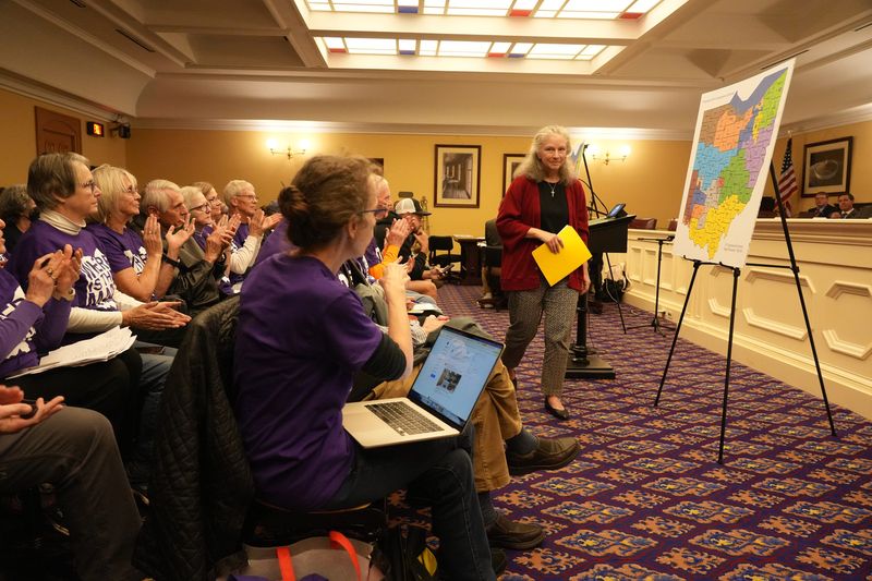
"There’s a lot of anger and frustration in this room, and it’s not just the result of this most recent betrayal. The anger and frustration has been years in the making," said Mia Lewis, associate director at Common Cause Ohio, which advocated for the failed 2024 ballot measure to put residents in charge of mapmaking. "You have shown all of us, all of Ohio, that politicians cannot be involved in drawing district lines."
Jen Miller, executive director of the League of Women Voters of Ohio, said the public was shut out, the process was rigged and incumbents were favored. "Republican and Democratic voters feel like their parties sold them out–and they're both right."
This article originally appeared on The Columbus Dispatch: Ohio approves new congressional map in bipartisan deal
Reporting by Jessie Balmert, USA TODAY NETWORK / The Columbus Dispatch
USA TODAY Network via Reuters Connect

 WKBN Ohio
 Tribune Chronicle Community
 WBNS Politics
 America News
 NewsNation Health
 AlterNet
 Local News in D.C.
 Raw Story