
 ABC57 News
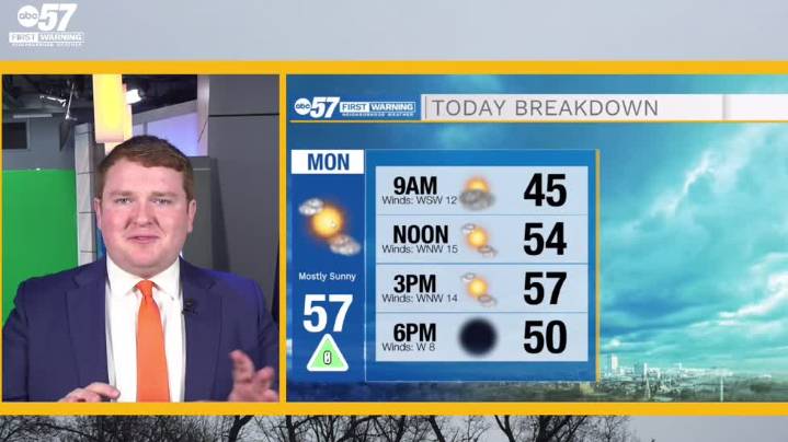
To view this video please enable JavaScript, and consider upgrading to a web browser that supports HTML5 video
A cold front arrives from the northwest later today and drifts slowly into our area later this morning and early in the afternoon. Temperatures remain unaffected, but isolated showers can't be ruled out completely. Lows drop into the mid 30s overnight and return to near 60 degrees tomorrow amidst partly cloudy skies. While not necessarily a permacloud, our area should expect consistently partly cloudy skies over the next several days with increasing rain chances this weekend.
Today: Mostly sunny. High 57.
Tonight: Partly cloudy. Low 36.
Tuesday: Partly cloudy. High 59.
Wednesday: Partly cloudy. High 60. Share

 Northern News Now
 WITN-TV
 K2 Radio Local
 WHAS 11
 KNOE
KNOE KKTV 11 News
 WIS News 10
 WBRC
WBRC Battle Creek Enquirer
 Courier Journal