
 PennLive Pa. Politics
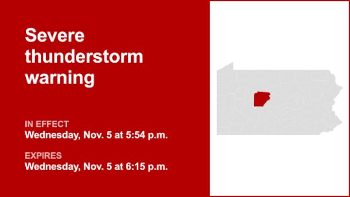
At 5:54 p.m. on Wednesday, the National Weather Service issued a severe thunderstorm warning in effect until 6:15 p.m. for Clearfield County.
Residents should prepare for wind gusts of up to 60 mph.
"At 5:53 p.m., a severe thunderstorm was located over DuBois, moving east at 60 mph," explains the weather service. "Expect damage to roofs, siding, and trees."
Locations impacted by the warning include DuBois, Clearfield, Sandy, Woodland, Hyde, Plymptonville, Rockton, Parker Dam State Park, Lecontes Mills, S.B. Elliot State Park, Falls Creek and Troutville. For those driving on Interstate 80, this includes areas between the Dubois and Kylertown exits, specifically from mile markers 97 to 129.
The weather service adds, "Stay inside a well built structure and keep away from windows."
Shield

 Lehigh Valley Live
 SIAdvance
 The Oregonian Public Safety
 Eyewitness News 3
 Gothamist
 KSL Utah
 KSLA News
 AccuWeather Severe Weather
 Timeout New York
 KPTV Fox 12 Oregon
 New York Post
 MyNorthwest
 CBS Sacramento Dixon News
 AlterNet