
 Eyewitness News 3
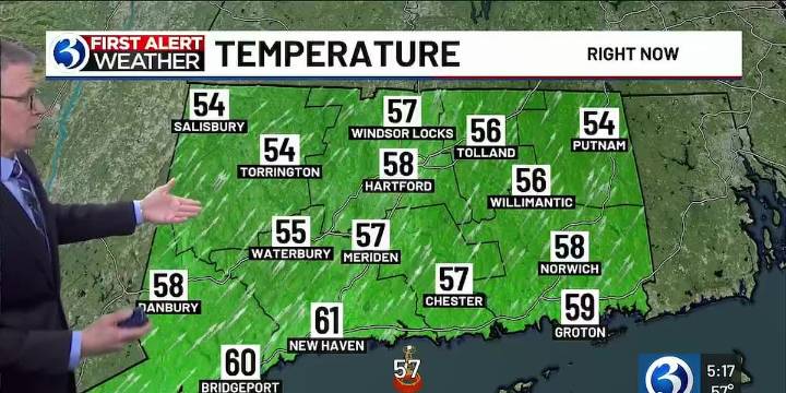
For any Alerts in effect for CT, click: here
THIS EVENING, TONIGHT...
We’re in a *First Alert Weather Day* as another quick-moving disturbance moves across New England. Initially, isolated downpours/storms are possible before midnight. Otherwise, the wind intensifies... gusts eventually could exceed 50 mph tonight! By daybreak, expect temps to bottom out in the upper 30s and lower 40s.
THE REST OF THE WEEK…
By tomorrow morning’s commute, the gusts will begin to relax a bit as high pressure builds our way. By the afternoon, it’s breezy and relatively cooler with highs in the upper 40s and low 50s inland, 50-55 at the shoreline under a mostly sunny sky.
Friday starts bright and chilly (lows near/below freezing), then cloud cover increases in advance of another storm system heading our

 KSL Utah
 Gothamist
 AccuWeather Severe Weather
 MyNorthwest
 WBRC
WBRC Timeout New York
 FOX Weather
 Detroit Free Press
 Raw Story
 Salon
Salon