
 FOX 59 News
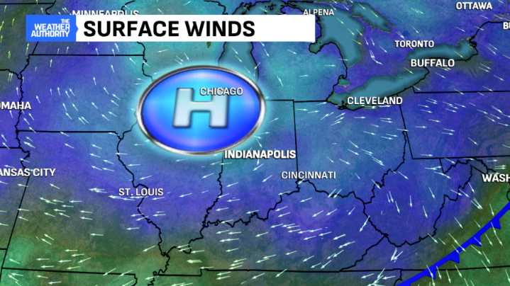
It is a much cooler start to the day with temperatures running nearly 20 degrees lower than Wednesday morning. Most locations have dropped into the mid-30s throughout central Indiana with wind chills in the upper 20s. Light, patchy fog is possible through daybreak.
Skies are mostly clear this morning and the dry conditions will persist throughout the day as a high-pressure feature builds into the area. Highs will rise into the upper 50s and lower 60s by the afternoon.
Cloud cover increases overnight as a wave of rainfall moves into the state. The rain gear is necessary for Friday morning's rush hour with peak coverage occurring during the first half of the day. Before the cold front arrives, highs will rise into the lower to mid-60s throughout central Indiana.
The weather pattern turns

 Talk 95.3 MNC
 93 WIBC Indianapolis
 Deseret News
 K2 Radio Local
 WSAZ NewsChannel 3
 The Weather Channel
 WSMV 4 Nashville
 Raw Story