
 KIMT News 3
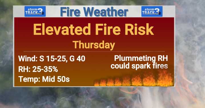
(KIMT) -- We've got quite the dynamic forecast on our hands for Thursday. To start, clouds will be a theme throughout the day with only a few peeks of sunshine expected. High temperatures are slated for the mid 50s.
Winds are set to increase drastically by Thursday afternoon with southerly gusts up to 35-40 MPH at times.
As these winds peak, relative humidity values will plummet to the 25-35% range due to a well-mixed atmosphere. This will result in elevated fire danger becoming a concern through Thursday evening. If you still to harvest some fields, please monitor your equipment for sparks. Please refrain from any outdoor burning Thursday!
These strong winds are ahead of our next passing cold front that is set to arrive Thursday night. As the front pushes through, a few spotty showers

 Eyewitness News 3
 Gothamist
 NECN Providence
 KSL Utah
 Lansing State Journal
 KSLA News
 Ocala Star-Banner
 Timeout New York
 AccuWeather Severe Weather
 WKOW 27
 Political Wire