
 WHAS 11
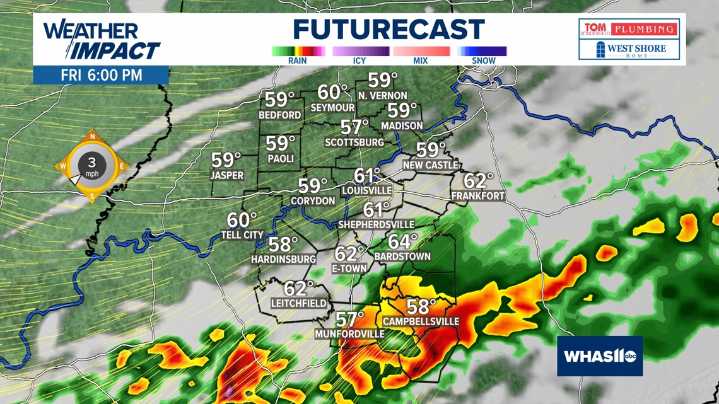
LOUISVILLE, Ky. — Friday is a Weather Impact Alert Day as we are tracking a system that will move into Kentuckiana bringing the potential for strong to severe storms late in the day Friday.
The Storm Prediction Center has noted a portion of Kentuckiana under a slight (2 out of 5) risk for severe weather. Areas along the Ohio River and south toward a line between Bardstown and Leitchfield, a marginal (1 out of 5) risk for severe weather has been issued.
Credit: WHAS11
Heavy rain and strong wind are the main threats as this system moves into Kentuckiana. As CAPE values will not be that high, the likelihood of tornadoes is quite low. Large hail and flooding threats are also low. That doesn't meanm that they aren't possible, the best chance for isolated spin-ups or large hail will be betwee

 KARK
KARK Times Herald-Record
 WISC-TV Channel 3000
 NBC Bay Area Dixon News
 People Human Interest
 WBKO
WBKO KCCI 8
 WAVE 3 News
 @MSNBC Video