
After a very quiet and nice couple of weather days, we'll switch gears again and track some rain and storms for Friday. The day should start off quiet with clouds increasing, also the wind will pick up. Gusts through the day could exceed 35 mph. Afternoon high temperatures will reach the mid 60s. A line of thunderstorms will mostly sit over south central KY and move east through the evening. This line could hold strong wind gusts as well as heavy rain and hail. The risk for tornadoes is about 2%, so it's not off the table. Once this front is finished, we'll dry out for most of Saturday. Even game time is still looking mostly dry and mild. Sunday will bring in one more cold front which will send our warmth packing by Monday. Highs will only hit the upper 30s Monday and yes, there is a chanc
Active way to end the work week
 LEX 18 News8 hrs ago
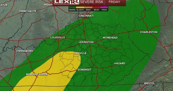
99

 FOX 26 Texas
 The Weather Channel
 Deseret News
 WSMV 4 Nashville
 K2 Radio Local
 WSAZ NewsChannel 3
 WKOW 27
 Watertown Public Opinion
 KXLY 4 News
 Wheeling Intelligencer