
 WLFI News 18
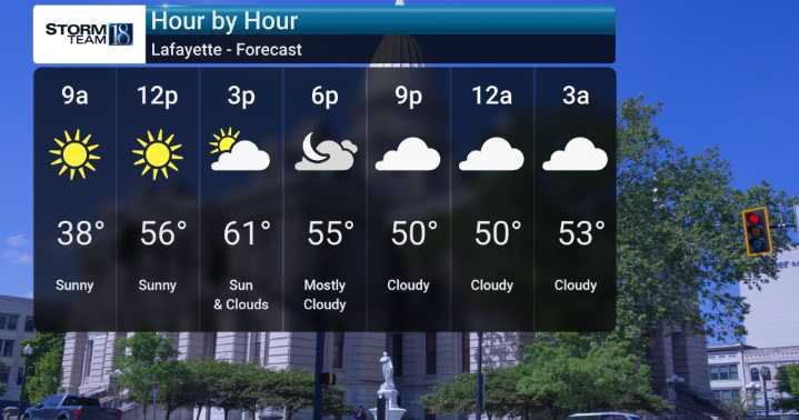
Today, we'll be keeping an eye on showers and isolated thunderstorms, especially during the first half of the day. Temperatures are expected to be unseasonably mild, reaching into the upper 60s, but this is the last of that warmth for a while.
As we head into the weekend, we'll see a noticeable cooldown begin. By Sunday, prepare for a much colder air mass to settle in with chances for light precipitation from late Saturday through Monday, and the likelihood of snow flurries, particularly Sunday night.
This transition will bring a dramatic drop from the milder temperatures. The Arctic air could bring multiple hard freezes early next week. Additionally, the winds will also pick up as this system moves in.

 FOX 26 Texas
 The Weather Channel
 Deseret News
 WSMV 4 Nashville
 K2 Radio Local
 WSAZ NewsChannel 3
 WKOW 27
 KXLY 4 News
 Mediaite
 ABC News Video