
 WREX
WREX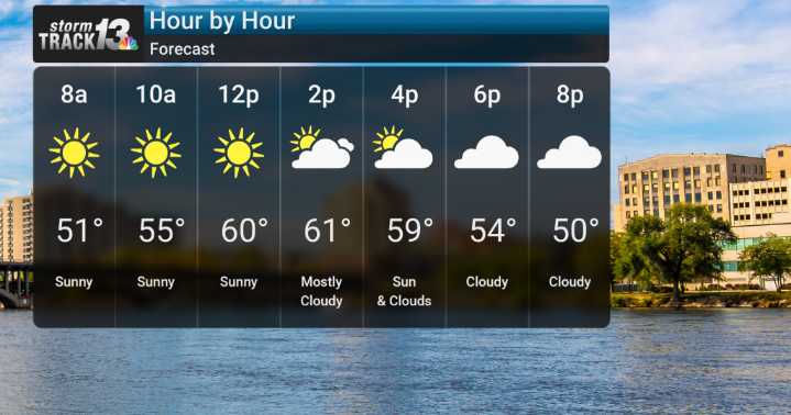
After a rather mild start to Friday with sunny skies and highs reaching the low 60s, we'll see changes tonight with clearing skies and chillier air.
As we move into Saturday, a storm system begins to approach, and we are expecting rain to develop later in the day. While most of the precipitation looks to be rain initially, with highs near 45F on Saturday, we could see some snow mix in on the backside of this system as cooler air wraps in Sunday morning, particularly north and west of the Fox Valley and closer to Lake Michigan. However, at this point, significant accumulations are not expected.
Sunday and into Monday, Arctic air is set to dislodge southward, bringing significantly colder temperatures. Highs on both Sunday and Monday are expected to struggle to get out of the 30s, with low

 FOX 26 Texas
 The Weather Channel
 Florida Today
 Deseret News
 WSMV 4 Nashville
 WTVM News Leader 9
 WMAR-2 News
 WIS News 10
 WKOW 27
 Watertown Public Opinion
 Blaze Media