
 The Tennessean
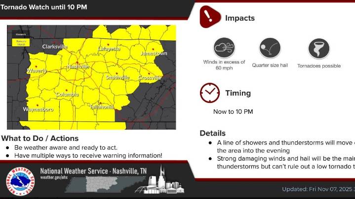
A tornado watch has been issued for much of Middle Tennessee until 10 p.m. Nov. 7 as a line of strong storms begins to push into the area from the west, the National Weather Service Nashville reports.
A line of showers and thunderstorms is moving east with strong, damaging winds bringing the possibility of a low tornado threat, the weather service said.
Wind and hail are the main threats, the weather service said.
Severe weather in Nashville triggered a ground stop at Nashville International Airport around 4:33 p.m. Nov. 7, the airport announced on its X account.
"Travelers should check their flight status with their airlines," the airport said in the post.
Middle Tennessee's tornado watch was issued around 3:37 p.m. Nov. 7.

 WAAY TV
 WHNT News 19
 Times Herald-Record
 LEX 18 News
 WCNC Charlotte Weather
 WAND TV
 The Weather Channel
 Fox 11 Los Angeles Sports
 Dickson County Source
 KRIS 6 News Weather
 WTVM News Leader 9
 KSNB Local4 Central Nebraska
 Bozeman Daily Chronicle Sports