
 WAAY TV
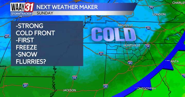
Our next weather maker arrives Sunday, bringing the coldest air of the season, along with our first hard freeze and a few snow flurries expected by Monday.
Today looks to be the last warm day for about a week, with highs in the low to mid-70s and partly cloudy skies. A rogue shower or two isn’t out of the question this afternoon.
By Sunday, our next cold front pushes through, bringing gusty northwest winds at 20–30 mph. Morning highs will be in the low 50s but will likely fall into the 40s by the afternoon.
Monday morning temperatures will be at or below freezing, with wind chills in the upper teens to low 20s. Highs will only warm to around 40, and there’s a chance of snow flurries, especially east of I-65.
A hard freeze is likely by Tuesday morning as temperatures dip into the mid-20

 WSAV
WSAV WAFB
WAFB FOX Weather
 KNOE
KNOE WBRC
WBRC The Bay City Times
 NECN Providence
 Hawaii News Now
 CBS News
 NBC Chicago
 ClickOrlando
 FOX 10 Phoenix Latest
 Deadline Politics