
 WAND TV
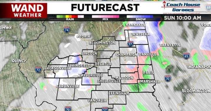
We have already seen scattered showers move through parts of our area and there are more on the way. Sunday morning those showers were mixed precipitation, meaning both rain and snow. Through the morning, more of those showers will push through, especially north of I-72.
Instead of temperatures rising through the middle of the day, today they will hold steady then fall. This means the best chance to see snow showers will arrive later in the day.
Overnight more lake-enhanced snow should move through our eastern communities. Those showers will be a bit heavier, so that round of snow could bring some minor accumulation. That potential for higher snow amounts in those areas prompted the National Weather Service to issue a Winter Weather Advisory for Iroquois county.

 WREX
WREX WISC-TV Channel 3000
 FOX Weather
 KNOE
KNOE The Bay City Times
 WBRC
WBRC Hawaii News Now
 WSIL-TV
 NECN Providence
 NBC Chicago
 CBS News
 ClickOrlando
 Clutch Points