
 WSIL-TV
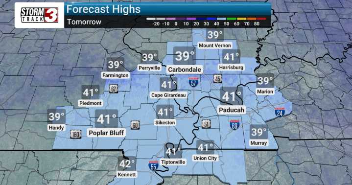
As the heart of a large system moves through our region late tonight and into Monday, we're expecting some significantly cold temperatures. We'll see nighttime lows into the hard 20s over the next two nights, with wind chills even dropping into the teens. This dip in temperature is well below average, making for some very chilly conditions. Highs on Monday will struggle to reach the 40-degree mark, a good 20+ degrees cooler than what's considered normal for this time of year.
As some energy aloft exits, there's a chance we could see a few flurries or light snow showers, especially to our north and east.
The good news is, this cold snap won't last long! By the middle of the week, we expect to see a welcome change as surface high pressure builds in. We'll be tracking a nice warm-up that ge

 KNOE
KNOE FOX Weather
 WBRC
WBRC Hawaii News Now
 The Bay City Times
 KOLO8
KOLO8 NECN Providence
 21Alive News
 NBC News