
 News 19 WLTX
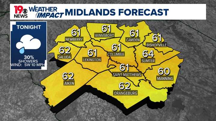
COLUMBIA, S.C. — The warm temperatures will continue into this weekend before a slight cool down to start next week.
Tonight, temperatures will remain warm, with lows in the lower 60s. Isolated showers or thunderstorms are possible late this evening into early Saturday. Counties in the northern Midlands have a slightly higher chance of seeing rainfall, with showers and storms beginning as early as 2 a.m.
On Saturday, near-record highs are expected, with temperatures climbing into the low 80s across the Midlands as warmer air moves in from the southwest. Any showers should move out of the area by late morning with partly cloudy skies through the afternoon.
Late afternoon, a cold front will pass through the area, bringing another chance for a stray shower or two. Most of the Midlands will

 @MSNBC Video
 Raw Story
 CNN Politics
 CBS News
 New York Post
 WILX News 10
 People Top Story