
 CBS DFW
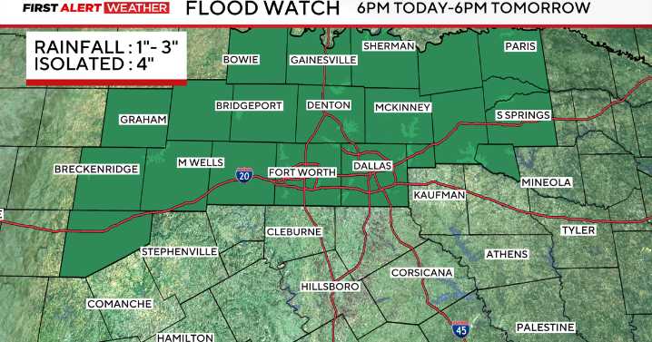
An area of low pressure is currently moving through the southwestern United States and is expected to move into the Southern Plains by Sunday evening.
This system will gradually increase rain chances, with isolated shower activity expected west of 35 Sunday afternoon. Rain is then expected to overspread the rest of the North Texas region late Sunday evening and overnight into Monday morning.
Due to the soil being already saturated from heavy rains late last week, the flooding threat is elevated, and a flood watch is in effect for the DFW metroplex and other areas that saw the most significant rainfall last Thursday.
The threat for severe weather is a marginal, 1 out of 5 threat on Sunday, for areas west of 35, where gusty winds and large hail will be the primary threats.
That threat fo

 America News
 Daily Voice
 Associated Press US and World News Video
 The Oregonian Public Safety
 NECN Providence
 KSNB Local4 Central Nebraska
 Newsweek Top
 Bozeman Daily Chronicle Sports