
 cleveland.com
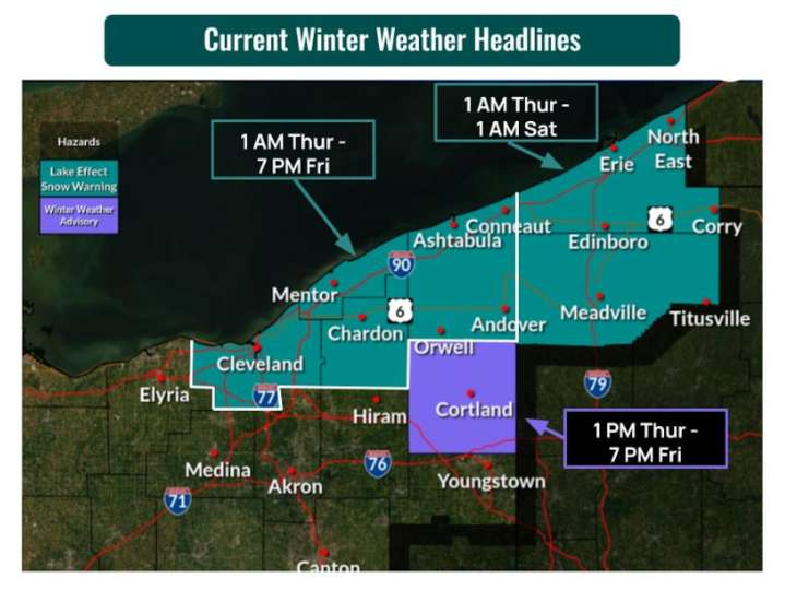
CLEVELAND, Ohio - A potent storm system will bring several hazards to Northeast Ohio Wednesday, including rapidly falling temperatures, strong winds with gusts up to 50 mph and significant lake effect snow for counties along Lake Erie through Friday evening, according to the National Weather Service.
The cold front moving through the region Wednesday morning will cause temperatures to plummet from highs in the mid-40s to low 50s early today to the 30s by afternoon and 20s tonight. Wind chill values will drop into the 20s today and the teens overnight. A Wind Advisory is in effect for the entire area, with sustained winds of 20 to 30 mph and gusts up to 50 mph expected through early Thursday morning.
Up to 16 inches of snow expected in snowbelt on Thanksgiving
Lake effect snow will devel

 America News
 AlterNet
 RadarOnline
 Los Angeles Times World
 Raw Story
 The Daily Beast