
 ABC57 News
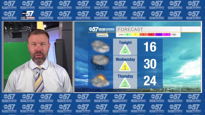
To view this video please enable JavaScript, and consider upgrading to a web browser that supports HTML5 video
Temperatures will struggle to break the freezing mark over the next week. Wednesday is the best chance to reach 32 degrees before lake effect snow begins in the afternoon. New snow accumulation for most will be an inch or less, but timing creates a bigger issue as snowfall is likely during the evening commute. The end of the week is cold, very cold with lows in the single digits Friday morning, and a windchill below zero. There's a chance of snow Sunday but the next round potential snowfall to watch is the middle of next week.
Tonight: Mostly cloudy. Low 16.
Wednesday: PM Snow Showers. High 31.
Thursday: Mostly Cloudy. High 28.
Friday: Partly cloudy. High 24. Share

 Akron Beacon Journal
 Local News in New Jersey
 Daily Voice
 Associated Press US and World News Video
 The radio station 99.5 The Apple
 NBC 7 San Diego Local
 KSNB Local4 Central Nebraska
 IndyStar
 The Oregonian Public Safety
 CNN Climate
 Raw Story