
 Syrancuse.com
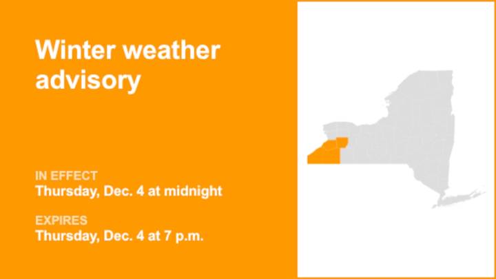
At 12:36 p.m. on Wednesday, the National Weather Service released a winter weather advisory valid for Thursday between midnight and 7 p.m. for Southern Erie as well as Wyoming, Chautauqua and Cattaraugus counties.
The weather service says to expect, "Total snow accumulations 2 to 5 inches in the most persistent lake snows, with the greatest amounts across the Boston Hills and Chautauqua Ridge. Winds gusting as high as 35 mph will produce blowing and drifting snow."
"Plan on snow covered and slippery road conditions with poor visibility. While snowfall amounts will be minor, much of the snow will fall in a brief, heavy burst. The hazardous conditions will impact the Thursday morning commute," explains the weather service. "Lake effect snow will fall in relatively narrow bands. If travelin

 SIAdvance
 Newsweek Top
 Akron Beacon Journal
 Local News in New Jersey
 Daily Voice
 Associated Press US and World News Video
 The radio station 99.5 The Apple
 NBC 7 San Diego Local
 KSNB Local4 Central Nebraska
 IndyStar
 CNN Climate
 The Oregonian Public Safety
 AlterNet