
 WRCB-TV
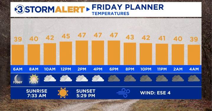
Good morning! Lingering drizzle and patchy fog will persist through 9 AM, leading to reduced visibility in some areas. Temperatures are ranging from 34 to 39 degrees this morning, keeping the threat of winter weather at bay. Conditions will improve later today with a few peaks of sunshine possible this afternoon. High temperatures will slowly creep into the mid to upper 40s.
There will be a chill in the air Saturday morning with temperatures starting in the 30s. Highs will rebound close to 50 with a mix of sun and clouds. Our next chance for rain arrives Sunday evening as a weak disturbance swings through the Tennessee Valley. Moisture will be limited, keeping rainfall amounts light and unimpactful. Enjoy your weekend! Next week is trending dry through the middle of the week with ch

 WGNO
WGNO KOAA News5
 KRIS 6 News Weather
 The Washington Post
 The Hill
 WWSB
WWSB Deseret News
 The Bay City Times
 WMAR-2 News
 Duluth News Tribune
 The Virginian-Pilot
 WFMY News 2
 Valley Central
 Salon
Salon