
 IndyStar
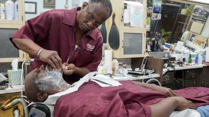
Leodis Moore Sr. has seen a lot of change in the 50-plus years he’s owned the barber shop at the northwest corner of 38th and Illinois Streets.
The next change could be a Republican-drawn congressional map that divides Indianapolis into four House districts along the 38th Street corridor, fragmenting historically Black neighborhoods near Moore's shop and drastically reducing the city's electoral power, critics say.
Many residents and Democrats say the proposed map seems blatantly designed to strip power from communities of color that line the major east-west thoroughfare. The new map would fracture the voting bloc that since 2008 has backed Democratic U.S. Rep. André Carson, drowning out diverse Marion County neighborhoods with heavily White suburbs and far-flung rural areas extending

 The Journal Gazette
 Local News Digital Stories
 The Times of Northwest Indiana Local
 WTHR Crime
 WTHR
WTHR 21Alive News
 The List
 CNN
CNN