
 21Alive News
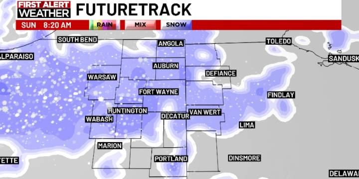
FORT WAYNE, Ind. (WPTA) - After a record cold morning (-3º compared to the record low of -2º set back in 1964) we’re going to see warmer temperatures all weekend long!
But that doesn’t mean winter weather has abandoned us yet...
Saturday will be mostly cloudy with highs near 30º, followed by a little light snow/freezing drizzle late Saturday evening/night ahead of a clipper system that will bring a swath of snow to the area Sunday morning.
While snowfall rates appear light (much lighter overall than what we saw last weekend), there could be a few hour period from about 8 am to 11 am where a burst of moderate snow is possible as the system nears its exit. The best way to describe it is like wringing a rag one last time before hanging it up! This period could produce a burst of quick accu

 The Jersey Journal
 NBC12
NBC12 Bozeman Daily Chronicle
 Los Angeles Times Opinion
 NBC News
 Raw Story
 The List
 America News
 Newsweek Top
 @MSNBC Video