
 WMTV NBC15
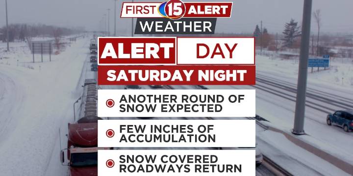
Snow arrives this evening with possible freezing drizzle, followed by 1-3 inches of accumulating snow Saturday night into early Sunday morning.
Early Sunday morning commute will be affected—highest snow rates between midnight and 9 a.m., especially near the Illinois border.
Below-normal temperatures continue into next week with additional snow chances possible as multiple weather systems move through.
MADISON, Wis. (WMTV) - Snow will move through southern Wisconsin this evening. While most areas will see light snow or flurries, some freezing drizzle may mix in between 8 p.m. and midnight, which could create a light glaze on untreated surfaces. Plan for slick conditions if you’re heading out tonight. Click Here for Interactive Radar
What’s Coming Up...
First Alert Day declared for Sa

 Associated Press Top News
 The Daily Beast
 RadarOnline
 NBC News
 Bloomberg Law
 Associated Press US News
 America News
 OK Magazine
 CBS News
 Blaze Media