
 SIAdvance
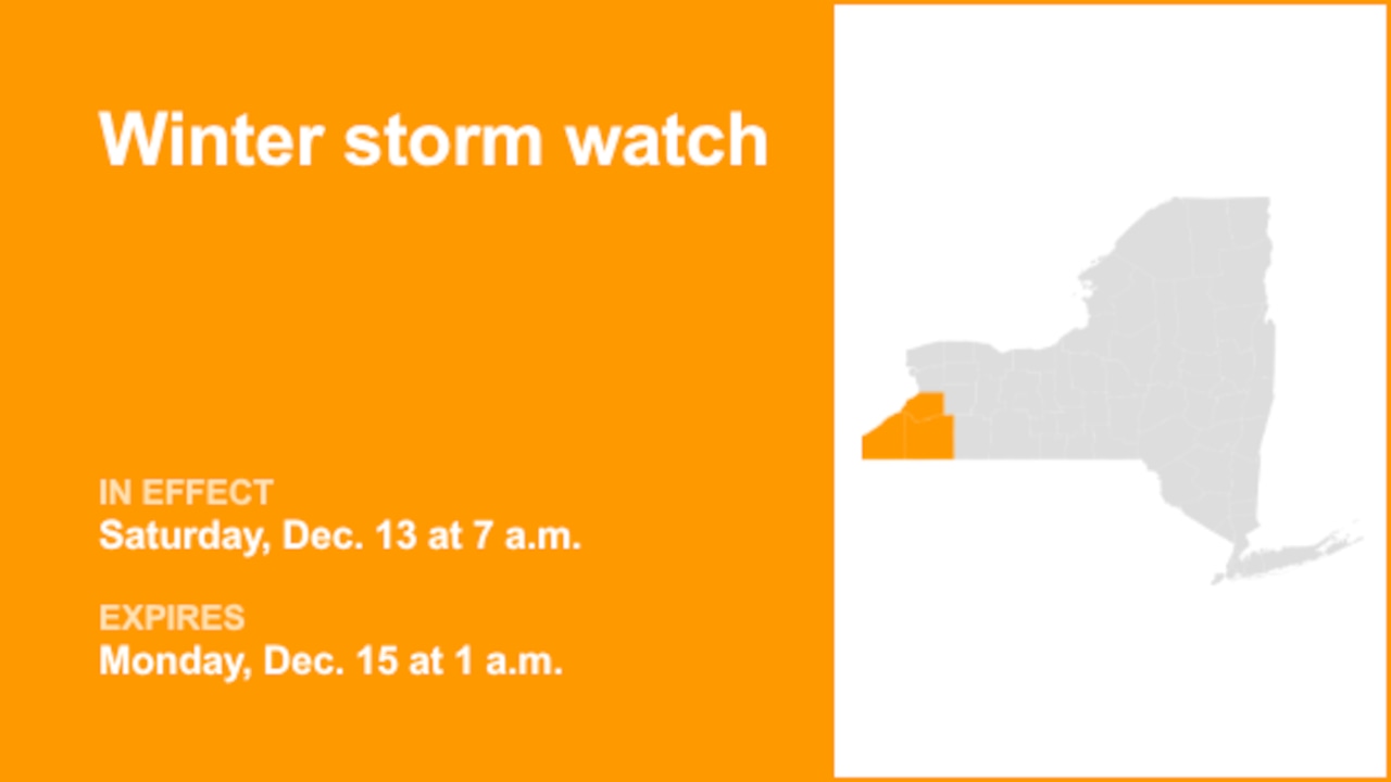
A winter storm watch was released by the National Weather Service on Friday at 1:30 a.m. valid from Saturday 7 a.m. until Monday 1 a.m. for Chautauqua, Cattaraugus and Erie counties.
The weather service adds, "Heavy lake effect snow possible. Total snow accumulations of 7 inches or more possible in the most persistent lake snows. Winds could gust as high as 35 mph, producing blowing and drifting snow."
"Travel could be difficult with snow covered roads and poor visibility," describes the weather service. "Narrow bands of heavy snow could bring rapidly changing road conditions and visibilities. Localized travel problems will be possible."
Staying safe on winter roads: Winter driving tips from the weather service
Winter's icy grip often turns roads treacherous, leading to over 6,000 weat

 Syrancuse.com
 Lehigh Valley Live
 Siskiyou Daily News
 KXLH
KXLH Eyewitness News 3
 KWWL
KWWL AccuWeather Severe Weather
 TMJ4 News
 The Seattle Times
 KSNB Local4 Central Nebraska
 WSAZ NewsChannel 3
 Aljazeera US & Canada