
 News Channel 36
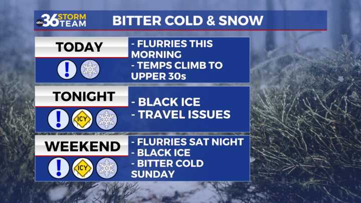
Friday: Winter storm will diminish through mid morning hours. Afternoon temps peak in the upper 30s/low 40s allowing for slight snow melting.
Friday Night: Temps drop back to 20s, leading to re-freezing and black ice issues for travelers.
Saturday: Temps climb to mid 30s. Snow flurries in the late afternoon through overnight hours for areas mainly I-64 and north. Temps fall to the single digits overnight.
Sunday: Frigid temps! Wind chills below 0° to start the day and temps only warm to the teens by the afternoon. Overnight lows near 0° with wind chills below °.
Monday: Bitter cold to start the day and highs only warm to the upper 20s with mostly sunny skies. Lows dip to the teens Monday night.
Tuesday: Temps looking a little better with highs in the upper 30s and lows in the mid/up

 WLKY
WLKY 1011 Now Lincoln
 WKOW 27
 Siskiyou Daily News
 WMAR-2 News
 KWWL
KWWL AccuWeather Severe Weather
 Eyewitness News 3
 WFMJ-TV
 Hattiesburg American
 The News Journal
 WSIL-TV
 The List