
 WREX
WREX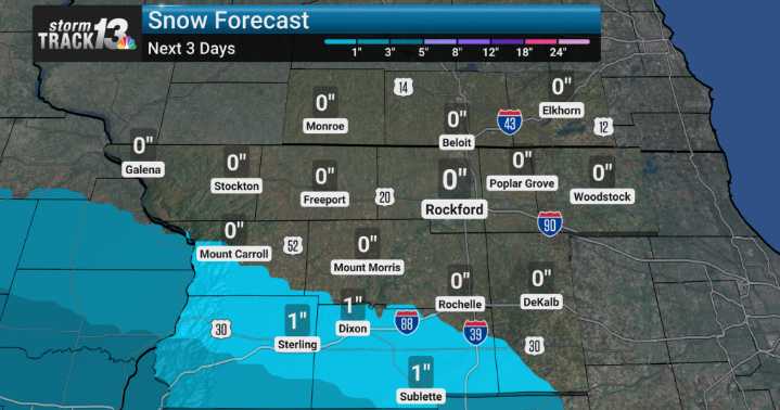
We're closely watching the developing pattern, and it's bringing a bit of everything, starting with some light snow chances for us today, Friday, especially as we head into the afternoon and evening hours.
We are keeping a close eye on Saturday. Forecast models are showing a more significant system moving in. Most of the snow from that system will fall south of Interstate 80, but a few of the counties in our southern viewing areas could see an inch or so of snow.
Following that Saturday snow, buckle up, because a blast of frigid arctic air is set to descend upon us. We're talking temperatures that are significantly colder than normal for this time of year, and more concerning, wind chills that will be brutally cold, dropping well below zero throughout the weekend, particularly Saturday n

 RiverBender East Saint Louis
 News Channel 36
 1011 Now Lincoln
 Siskiyou Daily News
 WMAR-2 News
 AccuWeather Severe Weather
 Eyewitness News 3
 KWWL
KWWL The News Journal
 WSIL-TV
 The Weather Channel
 KRIS 6 News Weather
 Ann Arbor News Life