
 WAFB
WAFB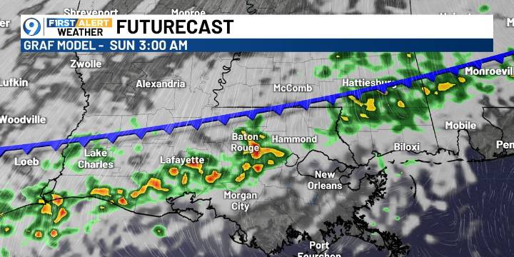
BATON ROUGE, La. (WAFB) - Get ready for some weather whiplash as warmth this afternoon gets replaced with the coldest temperatures so far this winter by early next week.
TODAY’S FORECAST
After a foggy and mild start, temperatures will climb into the upper 70s this afternoon under partly cloudy skies. An isolated shower is possible late this afternoon or evening.
The big change arrives overnight as a strong cold front moves through, bringing scattered showers and a few thunderstorms mainly overnight into early Sunday morning.
SUNDAY FORECAST
Behind the cold front, a few lingering showers and clouds may persist early Sunday morning. Skies will gradually clear through the day as breezy north winds pull in the cold air.
Temperatures will fall steadily through the day, setting the stage f

 KPLC
KPLC WBRZ News
 WWL-TV
 CBS News
 Oh No They Didn't
 AlterNet
 NBC News
 RadarOnline